In this summer, We decided to have a long drive through mountains and reach to Tungnath as a destination.
First a little background on the place.
Tunganath is the highest temple in the world and is one of the five and the highest Panch Kedar temples located in the mountain range of Tunganath in Rudraprayag district of Tehri Garhwal, in the Indian state of Uttarakhand. The Tunganath (literal meaning: Lord of the peaks) mountains form the Mandakini and Alaknanda river valleys. Located at an altitude of 3,680 m (12,073 ft), and just below the peak of Chandrashila, Tungnath temple is the highest Hindu shrine dedicated to Lord Shiva. The temple is believed to be 1000 years old and is the second in the pecking order of the Panch Kedars. It has a rich legend linked to the Pandavas, heroes of the Mahabharata epic.
Below is the route I took to burn the petrol. I believe the longest I could take. But I enjoyed my journey and the destination.
View Larger Map
Started off from Delhi early in the morning (4 AM) so that we reached Rishikesh by 10 AM, enjoying the highway tea and food.
 |
| Narendra Nagar |
 |
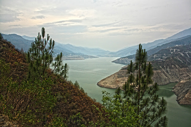
| Tehri Resevoir |
You can easily find places to stay here as there are lot of reasonably priced hotels.
Next morning the journey continues to visit Mussorrie and Kempty falls (around 70 Kms from New Tehri).
 |
| Kempty Falls |
 |
| Mussorrie |
So without wasting much time we came back to Tehri for a peaceful evening. Atleast this place is more peaceful and close to nature.
After a good rest and waking up fresh was the time to head towards the much awaited journey to Tunganath.
We packed our stuff and started early morning to a journey of 170 Kms through the hills.
How can anyone beat the lovely morning snacks on the way after couple of hours of drive.
You will keep seeing the beautiful fields across your journey.
Moving ahead Once you reach the Srinagar, you are accompanied by the river Alaknanda further in your journey.
 |
| Alaknanda River with its curves through the mountains |
Rudraprayag is one of the Panch Prayag (five confluences) of Alaknanda River, the point of confluence of rivers Alaknanda and Mandakini. Alaknanda then proceeds towards Devaprayag where it joins with Bhagirathi river to form the river Ganges
 |
| Alaknanda River |
 |
| Mandakini River |
 |
| Sangam At Rudraprayag |
Moving ahead towards the curves of the mountains you get to see the beautiful ranges.
Since this is a route to Badrinath as well, you would see devotees travelling barefoot.
After 25 more Kms we reach to Dugalbhita, we traveled for 6 to 7 hours and had been tiring. It was 5 PM in the evening. The important thing after Augustmuni is that the region dont have electricity, so its not advisable to drive in nights.
In Dugalbhita, there are few amazing camps to spend time with nature.
We stayed at The Magpie camps. Here are few important URLs for anyone interested.
http://www.mayadeepchopta.com/
http://magpieecotourism.com/index.html
After a nights stay moving to Chopta which is around 10 Kms away.
You just sit here and admire the natural beauty and the great Himalyan Ranges.
Peaks like Chokhamba, Trishuli, Nanda Devi, Kailash etc. are visible from here.
From Chopta, Tunganath is a 3.5Km steep trek.
 |
| On Way to Tuganath |
Finally we arrive at the Temple.
That is the reason why Uttharakhand is called Devbhoomi. The prayers are so close the the Almighty.
Chandrashila - Legend states that Lord Rama, the chief icon of the Ramayana epic, meditated at the Chandrashila peak
We could not get the chance to trek further 1.5 kms and it was very steep.
 |
| View of Chandrashila from Tunganath |
After a lovely journey to this wonderful place it was time to head back.
On way back we did spend a night at Devprayag.
 |
| Devprayag - Sangam of Alaknanda and Bhagirathi |
After this straight back to the heat of Delhi. It was much deserved break from the heat and wonderful holidays :).


